Naranjo de Alajuela (Naranjo)
Naranjo is a district of the Naranjo canton, in the Alajuela province of Costa Rica.
Naranjo has an area of 17.26 km² and an elevation of 1,043 metres. It is in the Central Valley (Valle Central), 31 kilometers northwest of the provincial capital city of Alajuela, and 47 kilometers from the national capital city of San Jose. It is also in close proximity to Ciudad Quesada, the Northern Lowlands, Monteverde, Guanacaste, and Arenal.
Naranjo has an area of 17.26 km² and an elevation of 1,043 metres. It is in the Central Valley (Valle Central), 31 kilometers northwest of the provincial capital city of Alajuela, and 47 kilometers from the national capital city of San Jose. It is also in close proximity to Ciudad Quesada, the Northern Lowlands, Monteverde, Guanacaste, and Arenal.
Map - Naranjo de Alajuela (Naranjo)
Map
Country - Costa_rica
 |
 |
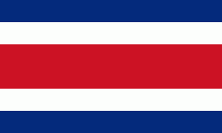
| Flag of Costa Rica | |
The sovereign state is a unitary presidential constitutional republic. It has a long-standing and stable democracy and a highly educated workforce. The country spends roughly 6.9% of its budget (2016) on education, compared to a global average of 4.4%. Its economy, once heavily dependent on agriculture, has diversified to include sectors such as finance, corporate services for foreign companies, pharmaceuticals, and ecotourism. Many foreign manufacturing and services companies operate in Costa Rica's Free Trade Zones (FTZ) where they benefit from investment and tax incentives.
Currency / Language
| ISO | Currency | Symbol | Significant figures |
|---|---|---|---|
| CRC | Costa Rican colon | â‚¡ | 2 |
| ISO | Language |
|---|---|
| EN | English language |
| ES | Spanish language |


